
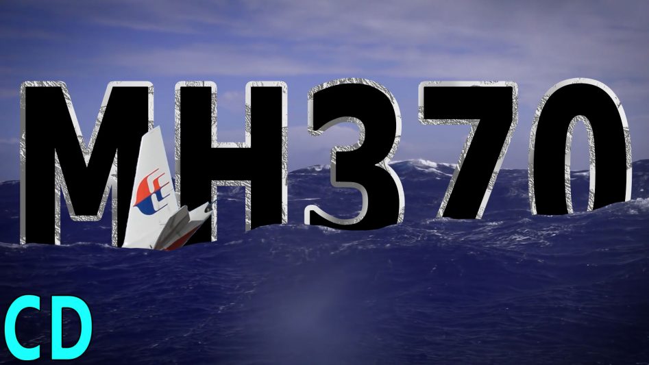
It’s been six and a half years since Malaysian Airlines MH370 disappeared on route from Kuala Lumpur to Beijing, China with the presumed loss of all 239 onboard. And yet despite the most expensive air and sea search in aviation history and launching a whole raft of conspiracy theories, only a few fragments of the plane have been discovered thousands of kilometres away on the other side of the Indian ocean but aircraft’s actual location is still a mystery. So considering the all effort that has gone in the recovery mission and the research into all the things we have found out since, why can’t we find MH370.
The loss of MH370 has become the biggest mystery in aviation history since the disappearance of Emelia Earhart and her navigator Fred Noonan in the central pacific whilst trying to circumnavigate the globe in July 1937.
But whereas Earhart’s disappearance has been thought of as a tragic accident, the loss of MH370 has boiled down to two possible outcomes. Firstly, something happened to the crew that incapacitated them and the plane flew on by itself until it ran out of fuel and crashed into the sea soon after, how it ended up in the Indian ocean when it was flying north to China still isn’t explained by this scenario.
The second is that someone on board took control of the aircraft and deliberately flew it to a remote part of the Indian ocean and ditched the plane.
Either of these outcomes is disconcerting. If the crew were incapacitated and the plane was left to fly by itself then it would be imperative to find the try and find the cause.
If however, it was a case of hijacking or pilot suicide and the murder of all on board, then the ramifications would be also worse for Malaysia as a whole. To many Malaysians, it’s almost unthinkable that a well-respected pilot of the national flag carrier could do such a thing and in an Asian culture loss of face is one of the worst things that can happen.
This highlights the problem that MH370 poses, we just don’t know where it went down, but to find it we need to know where it was in its final few hours.
Based on the evidence so far, it’s believed to be somewhere in the southern Indian ocean around an area defined by a set of radio messages sent from a maintenance system that was never in any way designed to be a location device and assuming it flew at altitude until it ran out of fuel.
Because there was no direct GPS tracking data sent from the aircraft, it’s final course and location had to be reconstituted from data picked up by the Inmarsat Satellite which received hourly maintenance broadcasts from the planes ACARS datalink system. In the time from the receiving of the last transmission to the crash which could have been anything from a few minutes to almost an hour, the aircraft could have flown on for hundreds of kilometres.
By comparing the timing delay from the ACARS system to it arriving at the satellite situated over the Indian ocean, the Inmarsat engineers were able to determine a possible route along the so-called 7th arc that stretched from central Asia in the north to the southern oceans in the south and passing about 2000km west of Perth, Australia.
Ruling out the northern path due to lack of radar evidence from the countries that it would have to have flown over, left the southern route as the most probable. The data pings also continued for a further six hours after military radar lost contact over Indonesia, meaning that it must have been in the air and operational during this time.
The issue of how MH370 ended up in the sea also has a major impact on where the wreckage is likely to be. If the aircraft was flying at a high altitude on autopilot without a crew and ran out of fuel then it’s likely to have ended up in a high-speed dive. In similar accidents like the 1998 crash of Swissair 111 into the Atlantic, the effect of the high-speed impact with the sea resulted in the plane breaking up into over 2 million pieces.
If MH370 did the same, then there would very few large pieces left to float away and the distance travelled from the time the engines flamed out to hitting the sea would have been quite short. In simulator tests, it was thought that it could have been up to about 37km.
If however, the plane was in a pilot controlled glide from the point of running out of fuel to making a controlled landing in the sea relatively intact, simulator tests showed the distance could be upto 130km. But this is assuming the pilot waited until it ran of fuel, he could have just ditched the plane whilst it was still under power before the fuel ran out to give the greatest chance of keeping the aircraft intact but either of these scenarios could place it a considerable distance from the initial search area.
By analysing the Inmarsat data and knowing the amount of fuel the aircraft was carrying, a search area of approximately 1,120,000 Km2 was defined, this was later prioritised down to 120,000 km2.
From 18th March to 29th April 2014, 21 aircraft flew 345 flights with a combined flight time of over 3,177 hours together with 19 ships from 8 countries.
The initial belief by the ATSB, the Australian Transport Safety Board was that the crew had been incapacitated by a hypoxia event like a sudden decompression and the plane had flown on autopilot until the engines flamed out due to lack of fuel. But this still had to take on a lot of assumptions such as flying in a straight line and at altitude, either of which could be wrong and could make a huge difference to where it really is.
But this scenario defined the initial search area which has been subject to underwater sonar scans in 2014 and has been the basis for all the subsequent searches.
However, investigators in the US and Europe believe the evidence points towards a manual control takeover of the aircraft to fly it into the southern Indian Ocean, an area renowned for rough seas, high winds and deep ocean floors, as the Australian prime minister Tony Abbot said its “as close to nowhere as it’s possible to be”.
Part of this conclusion comes from the course the aircraft took shortly after the last verbal communication and what happened next. All the data transmissions from the aircraft were suddenly lost along with all communications, pointing to someone turning off the main electrical power systems and then relying on up the emergency Ram Air Turbine to provide enough power to just fly the aircraft and keeping a very careful and well thought out course following the Thai – Malaysian border into straits of Malacca before turning towards the southern oceans.
This was done very carefully to avoid other aircraft and raising concerns of the multiple civilian and military Air traffic Controllers in the area. Once it was in the Indian ocean and out of Indonesian radar range, power seems to have been partially re-instated as the ACARS system started working again.
This scenario was added to 16 months later with the discovery of an almost intact starboard flaperon, something which crash investigators say would have been ripped apart by a high-speed impact with the sea. This was based on previous high-speed impacts like the Swissair 111 and computer modelling of how the flaperon would have reacted in varying crash scenarios.
The flaperon was also damaged in such a way as to indicate that it was extended at the time, something which would only have been done during a pilot controlled landing and if the aircraft had power. Only the trailing edge was eroded which suggests this was caused by it hitting into the sea during a ditching of the aircraft.
Then there was the discovery a flight path found on a computer flight simulator at the home of the pilot which followed a very similar path ending up in the approximate area of where its believed to have disappeared. There were about 1000 other flight paths found on the simulator but only one where the destination was the southern ocean, well away from any possible place to land safely.
32 pieces of debris have been found that could be linked to MH370 but only 3 have been positively identified. All these have been found on coasts thousands of km’s away on the other side of the Indian ocean which is pretty much where they were expected to be knowing the how currents flow around the from east to west.
No pieces have been on found the Australian coast even though it much closer to the presumed crash site than where they ended up. Experts say this proves it had to have come down in an area where the ocean current flows away from Australia and over to the western Indian ocean.
But whether that was much farther north or south of the ATSBs estimate remains unknown. The barnacle growth found on the Flaperon would only have occurred if it had been in the warm waters farther north for an extended period of time, leading some at the Royal Aeronautical Society to suggest that it could have been trying to land at Christmas Island but ran out of fuel due to flying at a much lower altitude of 5000 feet and slower speed since leaving the straights of Malaca rather than on to the Southern Indian Ocean. This is based on their extensive and exclusive investigation of the air traffic control responses from all those countries involved and the unusual course it took during the first part of the flight up until all radar contact was lost and it entering the Indian ocean.
But backtracking the debris from their final position to try and locate where they entered the ocean years earlier is a very imprecise science that can only give a general area over such long timespans but it doesn’t rule out a more northerly or southerly crash location.
During the initial search and to direct submersible vehicles close to the seafloor to take a closer look, high-resolution images of the ocean topography were required not only to know where they are going but also to know how deep they were. In the initial aftermath, some remote subs were sent to below there design depth simply because of the poor accuracy of the existing maps.
Although we have maps of all the ocean floors, most of these come from gravitational maps created from satellite data which have a resolution of about 2km per pixel. A greater accuracy of 300 meters per pixel is available from satellite mounted radar altimeters but this is still far too low resolution to find even the largest parts of an aircraft a few 10s of meters in size.
Due to the remoteness, bad weather and lack of commercial interest in the southern oceans there has been very little in the way of high resolution mapping done. What we do know is that the rugged ocean terrain in this area could easily hide an object like an aircraft even one the size of a Boeing 777.
To find something as small as an aircraft especially if it has broken up into smaller pieces requires high-resolution scanning equipment such as side-scanning and multibeam sonar. In the search, these were towed behind ships which travelled 24/7 across the search area. As the image data was coming in live, anything found that could be of interest was marked so autonomous submersibles could be sent down to investigate.
Although the underwater survey revealed a huge amount about the ocean floor in the area of the search, nothing from MH370 was found and the joint Malay, Chinese and Australian search was eventually wound up in January 2017.
In Oct 2017 the company Ocean Infinity offered to search for MH370 on a “no find, no fee” basis for the Malaysian government on the next most likely area based on the drift analysis conducted by CISRO the Australian national science agency. This new search area is a bit farther south and based on the ocean currents which travel towards Africa where all the existing wreckage was found.
In 2018, using the vessel “Seabed Constructor” and its eight Autonomous Underwater Vehicles, Ocean Infinity searched 120,000 km2 over 3 months, discovering more about the ocean floor and several shipwrecks at a depth of 3700 to 3900 meters dating back to the 19th century but again no sign of the missing plane.
And this is where we currently are, so could we find MH370 if we really tried, I certainly think so, we have already ruled out certain areas so we know where it isn’t. We could start searching to the north where the Royal Aeronautical Society think it is or to the south where the US investigators think it maybe but either way this is a very large area and there is still no guarantee.
So the sticking point now seems to be money, Malaysia is happy for third parties to restart the search on limited areas but only on a “no find, no fee” basis so there will be no blank cheques to look for it until found.
$200 million has already been spent on the search so far, making it the most expensive in aviation history. The 2018 search by Ocean Infinity would have cost the Malaysian government $70 million if they had found the aircraft. So working on that basis to produce a high-resolution search of a million square km would cost about in the region of maybe about $500M and take a couple of years if other ships were to join in the search.
If we really wanted to find MH370 come what may, and you had to perform a high-resolution search of a large chunk of the eastern Indian Ocean west of Australia before locating it, several billion might be needed but I wouldn’t place any bets on that happening anytime soon unless a benevolent billionaire decides to pitch in with some funding.
If MH370 is in the sea, then the only way we will find it in the deep ocean is with advanced sonar but this is a slow process with each sonar unit only able to travel at around 4 km/h. In recent years, advances in AUV’s or Autonomous Underwater Vehicles has allowed multiple units to work together as a group covering a much greater area in the same time, essential for large searches like for MH370.
These advances need skilled technicians not only to develop them but also operate them and one way you can build up your skills is to use something like Brilliant, the sponsors of this video.
Brilliant is a problem-solving website and app so you’re not tied to the desktop and you can help develop those learning skills anywhere. Basically, brilliant breaks down complex problems into small easily understandable parts before putting them back together to show the overall conclusion.
There are loads of great interactive courses and daily challenges covering everything math and logic to quantum objects and computer science and loads of other things in between.
This hands-on active learning approach is great for all those curious minds you who want to understand the world.
If you want to support Curious Droid and get unlimited access to all of Brilliant’s in-depth courses and learning, head over to brilliant.org/curiousdroid/ to get 20% off their annual Premium subscription.
So just to rounds things off, I would just to say thank you to all our patroens and their ongoing support.